Tuesday 9 April 2024

Whitstable parkrun

Whitstable is a coastal heritage town in the north of the county of Kent with a population of around 32,000 people. There is evidence of occupation here since palaeolithic times. The town's name is thought to be made up of the Old English words 'hwit' as in 'white' followed by 'stapol' as in a pole, pillar or post and essentially means 'white post'. However it could also have other meanings and the simple fact is that no-one actually knows the truth.

It was recorded in the Domesday Book as Witenestaple which then evolved into Whitstaple by the early 13th century and into its current form by 1610. It was for some time also known as Whitstable-on-Sea. In the mid-eighteenth century, the town was served by the hoys boats which brought in visitors from London. It was also the northern terminus of one of Britain's first passenger railways, the Canterbury and Whitstable Railway.


It is known that the Romans were present in Whitstable, as remains of a Roman-era building have been found in the centre of town. It was apparently the Romans that popularised Whitstable's famous oyster beds just off the coast of the town and as they were regarded as a delicacy, they had them shipped all the way to Rome. The oyster industry continued to prosper long after the Romans left and at its peak in the 1850s around 80 million oysters per-year were transported to London's Billingsgate market to be sold. At this time Whitstable was regarded as one of the world's premier oyster producers. The industry lives on into the present day and the town also hosts the Whitstable Oyster Festival every year during the mid-late summer.

Another large and highly prosperous local industry began in 1588 when a mine was opened in the suburb of Tankerton, and this created the local copperas industry. This substance was used as a fixative for dyes and in the manufacture of ink. Incidentally, in 2017 the wreck of a Tudor-era merchant ship was discovered on Tankerton Beach, which is thought to have been connected to the copperas trade - it is unique as being the only medieval shipwreck to exist in south-east England. The wealthy owners of the business, also holders of the Manor of Tankteron built themselves a large house which over the years went on to evolve into what is now known as Whitstable Castle. It still stands and although the castle itself is only open for events, the gardens and playground can be visited free-of-charge.


Tankerton has north-facing slopes that run down to the shore which provide ideal growing conditions for an aromatic flowering plant called Hog's Fennel. In fact, it is the largest area of Hog's Fennel in the whole of Britain. The presence of this plant makes it the perfect breeding ground for two rare moths called Agonopterix Putridella and Fisher's Estaurine Moth, whose respective caterpillars feed exclusively on Hog's Fennel. This led to the Tankerton Slopes being designated as a Site of Special Scientific Interest in 1986. Tankerton itself became popular during the seaside heyday in the late 19th century and its design largely dates from this period. The seafront once featured a pier but this was demolished the early 1900's.

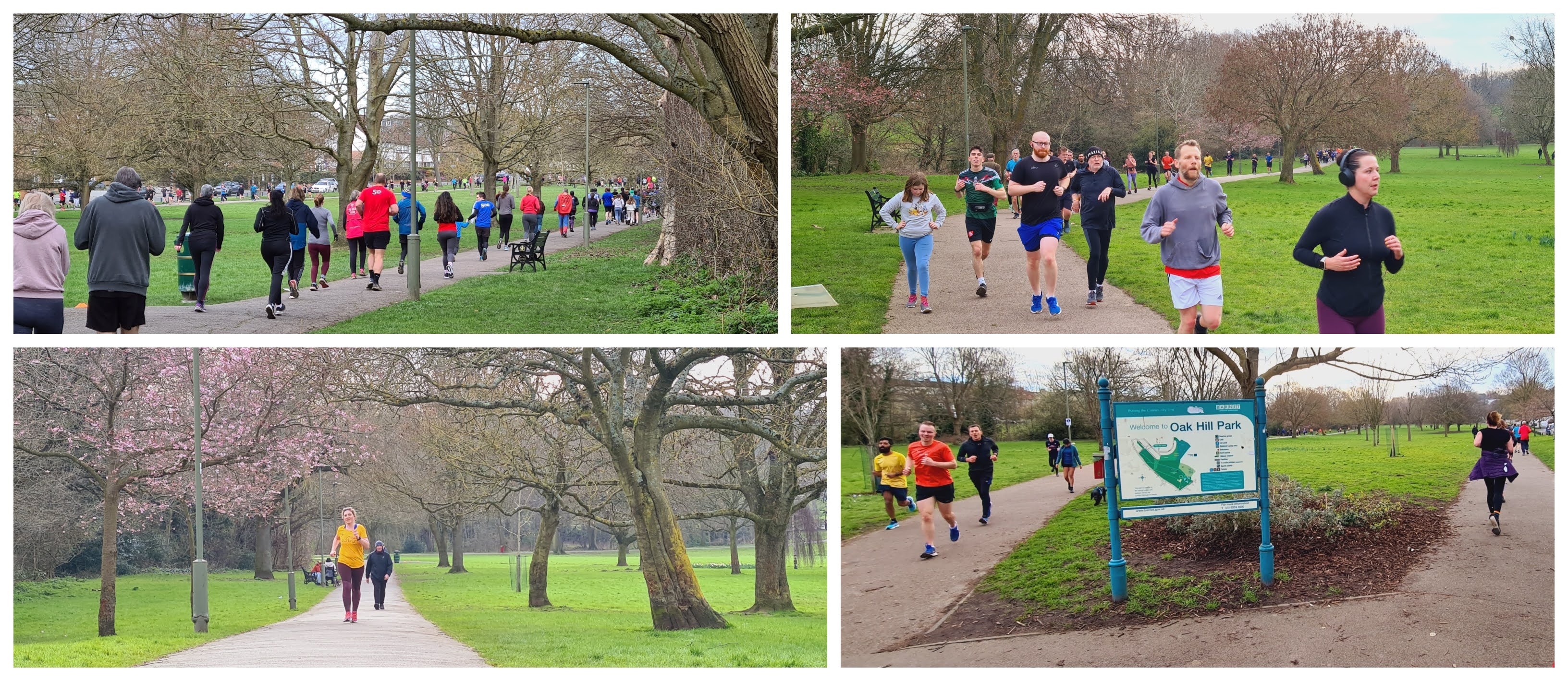
It is the seafront at Tankerton that provides home to the town's free, weekly, timed 5-kilometre event called Whitstable parkrun, which has been in operation since 6 November 2010. The event is open to all abilities including wheelchair users and to those who wish to walk the course. This parkrun is significant as it was the first to be held in Kent, and this was thanks to the efforts of the former event director Jacky Macdonald who is quite a legendary figure in this part of the country. It flew the flag as the county's only parkrun for almost two-and-a-half years until in 2013 there was a fast-paced explosion of new Kent events, supported by Jacky in her role as parkrun's Kent ambassador. By the end of that year there were eight parkruns in the county. At the time of writing there are twenty-five 5k parkruns in Kent.


I first took part in the event back in February 2014 and wrote about it in my original Whitstable parkrun blog (note: an alternative course was used, but not the current alternative course). I revisited in April 2024 which gave me the opportunity to produce this much-needed updated write-up. On both occasions I travelled to the event by car and parked for free on the local streets; Marine Parade is the obvious street to aim for as this is adjacent to the course. The parkrun meeting point is next to the Tankerton Ice Cream Parlour (opposite St Anne's Road), so the favoured parking spots tend to be those closest to the parlour and the adjacent tennis courts. However, the free parking stretches all the way to the east along Marine Parade, so finding a space shouldn't be a problem. The adjacent side-streets also have some on-street parking bays, but please note that these tend to have a 1 hour maximum stay.

Travel by public transport is also possible as the town has a mainline train station, Whitstable, which is just under 1 mile away from the parkrun meeting area. The station is served by Southeastern train services on the London to Ramsgate trainline, running primarily out of London Victoria station. If using the bus, the closest bus stop is located at Tankerton Circus on Tankerton Road, and this seems to be served by many services including the 660, 903, 904, 906, 922 and the Triangle. There also seem to be other services that stop in the centre of Whitstable, such as the number 5 Stagecoach Southeast bus. Cyclists, who have good links from Canterbury via the Crab and Winkle Way, and to other local seaside towns via the seafront path, can secure their bikes at one of the bike racks outside the ice cream parlour.


Once at the meeting point, the toilets are advertised as being open from 7.30am and can be found within the same building as the ice cream parlour. Should these toilets be closed, the closest alternatives are next to Tankerton Bay Sailing Club, to the east or within the lower floor of The Bubble cafe, to the west. The first timers' and main briefings take place on the grass area next to the toilets and once complete, everybody heads down the steps or slope onto the promenade. A handy thing to note is that in general, those who are likely to be within the first half of the field may find it better to take the stairs which join the promenade closer to the front of the start line. The slope (Kiosk Hill) is a better route for those likely to be participating further back in the field as this joins the promenade to the rear of the start area.

The Whitstable parkrun 'regular course' takes place over an almost-two-lap clockwise route taking in both the lower promenade and the upper grassed area, and it is this course that is covered in this write-up. The course is essentially flat, but the slopes used to change between the different levels obviously add in an incline/decline element. The surfaces underfoot are a mixture of the concrete promenade path and the grass on the upper section, so the best footwear may vary from week-to-week. If it's lovely and dry, road shoes are ideal, while if the conditions have been wet, the grass can hold onto quite a bit of water and could be muddy and quite splashy, and this could swing the preference towards trail shoes. Please note that if the conditions on the grass pass a certain threshold, the event team may switch to the alternative course (also known as the lollipop course) - there are some notes on the alternative course towards the bottom of this page.


So, at 9am the parkrun starts and the field heads off in an easterly direction. The promenade has a fixed width due to there being a retaining wall on the right between it and Tankerton Slopes, and on the left-hand-side this part of the prom is raised about half-a-metre higher than the beach. The point is that if you happen to line up a bit further back than you would have preferred, you'll have to be patient and filter through as the field thins out. Eagle-eyed parkrunners looking out to sea will spot a couple of interesting things. Firstly, there is the Kentish Flats Wind Farm, which is 10 kilometres off the coast and consists of 45 turbines. Secondly, and these are a little harder to see, are the Maunsell Sea Forts. These were anti-aircraft defensive positions which would have housed searchlights and anti-aircraft guns during the Second World War.

The parkrun course continues along the prom, which is marshalled at regular intervals. However, the path is also part of the National Cycle Network, so keep an eye out for cyclists. Initially the scene stays the same with the Hog's Fennel growing on the adjacent slopes. After a while the foliage gives way to an area of beach huts which are painted in all sorts of wonderful designs and colours. These are highly desirable and are currently selling for anything between £50,000 and £86,000.


Just after the beach huts is Tankerton Bay Sailing Club, where you'll find plenty of boats lining each side of the path. Once past the boats, the prom section of the course comes to an end and the route bears off to the right with a climb up Fraser Hill, incidentally this is usually marshalled by a volunteer called Fraser. At the top of the hill there is a sharp right hand turn onto the pavement where the parkrun course then moves onto the grass.

The elevated position at the top of the slopes gives a wonderful view across Tankerton Beach and onwards with the eastern side of the Isle of Sheppey visible in the far distance. The grass underfoot is generally in good condition, but I will note that it does have an interesting feature where pools of water seem to form in random positions. Also, it can be quite difficult to spot them in advance, so it would be very easy to end up with a soaking wet foot (hint: have spare shoes and socks with you if it has recently been raining). There were also some sections that were a little muddy, but as noted above, if the underfoot conditions get too bad it is likely that the event will switch to the alternative course. There are a few shelters to pass and some paths to cross, but soon enough the familiar sight of the Ice Cream Parlour can be seen and the course reaches the original briefing area.


On the first lap, the course goes through this area and then heads down Kiosk Hill, which I'd note as being particularly steep. My GPS data reports the slope as being a -10.9% gradient at its steepest point. At the bottom a sharp right-hand turn feeds the parkrunners back onto the promenade and past the start line where the lap is completed a second time until reaching the original meeting/briefing area, which is now the finish area. The barcode scanning area is well organised with separate queuing areas marked out with rope and small buckets for participants to deposit their finish tokens once scanned. The results are processed and are available online a short while later. As a guide, expect to find somewhere in the region of 350-450 participants at this event, but it can occasionally exceed 500. On the day we visited in April 2024 (event 643), there were 366 plus 51 volunteers.

As noted above, I recorded the course (regular course) with my Garmin and the GPS data can be found on my Strava account. The data was also used to create a Relive course fly-by video and it can be viewed on YouTube. Should the need arise, the route can be changed to the 'alternative course' which is a lollipop-style course and takes place over a single lap.


For the lollipop course, the parkrun starts in the same way but continues past the Fraser Hill turn-off point and instead heads right to the very end of the prom. The lollipop part of the course is within the adjacent nature reserve, called Long Rock. Interestingly, Long Rock Beach used to be a Nudist/Naturist beach. The ground with the nature reserve can be muddy and rutted, plus there is also a pinch point and a small step up onto a wooden bridge. Once the loop is completed, the route follows the prom all the way back, then turns up Kiosk Hill and the finish is found at the usual place next to the Ice Cream Parlour.

At time of writing (April 2024), I have not personally taken part on the lollipop course, but I have acquired the GPS data for it, so that can also be viewed on Strava and the course fly-by on YouTube. I would also note that the continued use of this alternative course is not guaranteed as the Long Rock area may be undergoing some changes including the installation of a shingle path.


Post parkrun, the Whitstable parkrun family heads off to either the Marine Hotel or sometimes one of the other local cafes on Tankerton Road. We had brought some food and drink with us so we didn't partake in the official refreshments. Instead we got started with our planned day out in Whitstable starting with a trip to Whitstable Castle where our five-year-old spent ages playing in the playground. The day continued with a walk over to Whitstable Harbour before continuing along the seafront path taking in all the sights including the famous Old Neptune pub which stands right on the beach. We also found the house of one of Whitstable's famous former residents, Peter Cushing, star of many of the Hammer horror films and who also played the part of Grand Moff Tarkin in the 1977 Star Wars film.

We then headed away from the seafront and found some of the wonderful alleys that Whitstable is well-known for, including Squeeze Gut Alley and I can confirm it really is a squeeze to get through one section of it. This led us through to Whitstable Museum and Gallery (£4 entry for adults, under 18's free) and here we learned about Charles and John Deane who invented the deep sea diving helmet while living in the town. This equipment led to John becoming one of the first people to recover artefacts from the Mary Rose. We also learned about Whitstable's ship building and repair trades, which existed for about 400 years with the last one closing in 1985. One of the highlights of the museum is 'Invicta' which is the original steam engine which ran on the Canterbury and Whitstable Railway. We also saw some of the filming locations for a recent TV show called Whitstable Pearl which is filmed almost entirely in the town. We had watched the first series during the week leading up to our visit (it's currently on UKTV Play).


In preparation for our visit, I had also checked the Whitstable tide times as I wanted to see a quirky natural feature on the seafront called The Street. This is a shingle strip which is exposed at low tide and stretches about 750 metres out to sea. We arrived about 90 minutes before the low tide was due, but already The Street had started to emerge, so even though the full length hadn't been revealed, we managed to take a walk to the end as it was at the time. By the time we arrived back at the car, we had covered a total of 10 kilometres during our walk and were well and truly exhausted.

We had a brilliant time in Whitstable and that of course started with the wonderful Whitstable parkrun. As I mentioned in my original blog, it is a well-oiled machine, and you are sure to receive a very warm welcome. A huge thanks goes to the 51 volunteers that made it all possible.


Related Links:


Monday 1 April 2024

Alliterative parkruns

The definition of alliterative parkruns that I've been using for my challenge on the 5k app is 'parkrun venues where the name of the venue has two or more words preceding the word parkrun, and each of those words start with the same letter'. An example of this is Clapham Common parkrun. However, the actual definition of alliterative or alliteration may be a little different, as it can also apply to non-consecutive words.

In the list below, I have included all the 5k parkrun venues that are undoubtedly alliterative, plus venues which may have an alliterative name. Where I have some doubt, I have added a question mark and you can make up your own mind as to whether these should be included.

The list below should be correct as of 1 April 2024. I have visited nine of them and, for those venues, a link to the related write-up is provided. Please let me know if you spot any I've missed.

  • Bannockburn Bush (Australia)
  • Batemans Bay (Australia)
  • Bendigo Botanical Gardens (?) (Australia)
  • Betty's Bay (South Africa)
  • Big Bay (South Africa)
  • Bryn Bach (Wales, UK)
  • California Country (England, UK)
  • Cannibals Cave (South Africa)
  • Cannock Chase (England, UK)
  • Carnival City (South Africa)
  • Cascades on Clyde Wetlands (?) (Australia)
  • Century City (South Africa)
  • Charleys Creek (Australia)
  • Chelmsford Central (England, UK) (write-up)
  • Claisebrook Cove (Australia)
  • Clapham Common (England, UK) (write-up)
  • Clare Castle (England, UK) (write-up)
  • Cliffe Castle (England, UK)
  • Clitheroe Castle (England, UK)
  • Coed Cefn-pwll-du (?) (Wales, UK)
  • Colchester Castle (England, UK) (write-up)
  • Coldham's Common (England, UK)
  • Cranbrook Country Park (?) (England, UK)
  • Crathes Castle (Scotland, UK)
  • Crawfordsburn Country (Northern Ireland, UK)
  • Curl Curl (Australia)
  • Cyril Curtain Reserve (?) (Australia)
  • Denton Dene (England, UK)
  • Du Bois de Boulogne (?) (France) (write-up)
  • Dunstable Downs (England, UK) (write-up)
  • East End (New Zealand)
  • Epworth Equestrian (England, UK)
  • Faskally Forest (Scotland, UK)
  • Fell Foot (England, UK)
  • Fodder Forest (Australia)
  • Gainsborough Greens (Australia)
  • Hampstead Heath (England, UK) (write-up) (re-write coming soon)
  • Harcourt Hill (England, UK)
  • Hastings High School (?) (England, UK)
  • Heritage Harbour (United States)
  • Houghton Hall (England, UK) (write-up)
  • Kedzierzyn-Kozel (?) (Poland)
  • Las Lagiewnicki (?) (Poland)
  • Lillydale Lake (Australia)
  • Llyn Llech Owain (?) (Wales, UK)
  • Loch Leven (Scotland, UK)
  • Melton Mowbray (England, UK)
  • Mullum Mullum (Australia)
  • Paradise Point (Australia)
  • Peter Pan (England, UK)
  • Philips Park (England, UK)
  • Phoenix Park (South Africa)
  • Picnic Point Parklands (Australia)
  • Point Hut Pond (?) (Australia)
  • Preston Park (England, UK) (write-up)
  • Rocks Riverside (Australia)
  • Samuma Koikikoen Kanouen (?) (Japan)
  • South Shields (England, UK)
  • Sunrise-on-Sea (?) (South Africa)
  • Sunset Hills Shitasanbashi (?) (Japan)
  • Talkin Tarn Country Park (?) (England, UK)
  • Tamar Trails (England, UK)
  • The Terrace (Australia)
  • Tsujido Kaihin Koen (?) (Japan)
  • Tubbercurry Trail (Ireland)
  • Weltevrede Wine Estate (?) (South Africa)
  • Wendover Woods (England, UK) (write-up)
  • Whitemark Wharf (Australia)
  • Wolford Wood (England, UK)
  • Worsley Woods (England, UK)
  • Woy Woy (Australia)
  • You Yangs (Australia)
  • Zalew Zyrardowski (Poland)


Sunday 24 March 2024

Swanscombe Heritage Park junior parkrun

Swanscombe is an area in the north east of the Borough of Dartford, in Kent, with a population of around 6,500 people. The earliest mention of the name is from 695AD, and over the years has been recorded as Swegenscomp, Swanescampe, and in the Domesday Book as Suinescamp. The motto of the County of Kent is 'Invicta', which comes from Roman times and means unconquered. It is generally accepted that this comes from Kent's conditional surrender to William the Conqueror after his victory over the last Saxon King of England, Harold II, at the Battle of Hastings in 1066. It is claimed that the men of Kent met (or intercepted) William at, or near, Swanscombe, on his journey to London and offered a peaceful transition if he agreed to grant their ancient rights, which he did.

Swanscombe and its adjacent areas have a long history of being quarried for the materials required to support north Kent's cement production industry. One of these vast quarries is now home to Bluewater shopping centre, which lies just to the west of Swanscombe. Another quarry was called Barnfield Pit, and a number of archaeological finds, including a number of hand axes.


The most significant discovery here was made in 1935, 1936 and 1955 when three fragments of the same skull were found. Further analysis showed that the skull belonged to an early or pre-neanderthal person, and it dates from around 400,000 years ago. It was initially known as Swanscombe Man, although further investigations suggest that the skull actually belongs to a woman. It is one of only two Lower Palaeolithic human fossils to ever be found in Britain (the other one is known as Boxgrove Man). The Swanscombe Skull is on display at the National History Museum. 

Quarrying at Barnfield Pit ceased, possibly in 1936, and it was subsequently backfilled with Thanet Sand. In 1954 it was made a National Nature Reserve when it was donated to the nation by its owner, the Associated Portland Cement Company. The site is technically owned by Natural England and is leased to Swanscombe and Greenhithe Town Council where it is open as a public park called Swanscombe Heritage Park. It covers an area of 9.6 acres and in 1988 was designated a Site of Special Scientific Interest. The park was given a makeover in 2005 where new interpretation boards, set within large split granite rocks, were installed and new pathways created. At the main entrance is an oversized sculpture of a 400,000 year old hand axe that was found at the site. It was unveiled at the park's re-opening ceremony in June 2005 by archaeologist Phil Harding, who is most well-known as being part of Channel 4's Time Team series.


In March 2024 the park became home to Swanscombe Heritage Park junior parkrun, which is a free, weekly, timed 2k event. The junior parkrun series takes place on Sundays and is open to children of all abilities aged 4-14. Participants should be registered and have been issued with their own personal barcode before taking part, this personal barcode will be required for scanning at the end of the event.

There is a free-of-charge car park which is next to Swanscombe Leisure Centre, just off Craylands Lane. The closest train station is Swanscombe and this is located about 1 kilometre to the east. My understanding is that there are no bus services that stop at the park on a Sunday, but there are some services that stop on London Road, which is not too far away. Once at the park's main entrance, the huge hand axe sculpture is the most distinctive feature. Once at the sculpture, there are a choice of three paths to follow - the meeting point for the parkrun can be found by following the middle path. If you require a toilet, just pop into the leisure centre before entering the park.


The entire parkrun is set within the park's rectangular central open grass area which I'd say is roughly the size of two adjacent football pitches. The perimeter measures almost exactly 500 metres and is mostly bordered by trees, bushes or a sloped bank. The grass area is totally flat and seems to cope well after wet weather, I expect the drainage is good owing to the park sitting on the back-filled sand. As is standard at junior parkruns up and down the country, the kids are given a briefing which is followed by the legendary junior parkrun warm-up! This takes place at the start area which is on the north-east side of the grass field.

The course could easily have been four identical laps around the perimeter, but that would most likely end up being a little chaotic with lots of lapping and the very youngest children having no idea how many laps they had done at any given point. So...


... in order to make it a little more manageable, and a little bit more fun, a two-and-a-bit lap course has been designed. This features some parts where the course sticks to the perimeter, but also a central section which is affectionately called 'The Snake'. Underfoot is 100% grass and as mentioned above, it is flat. As far as footwear is concerned, in the winter I would say that a trail-style shoe may be better than a road-style shoe, but it's a fun kids event, so I guess they will wear what they feel happiest in.

From the start on the north-east side, the junior parkrunners (and probably a few accompanying adults) set off in a clockwise direction, initially following the perimeter of the field.


At approximately half-way into the lap, on the western side of the field, the snake section begins. The course turns into the inner grass area and heads straight across before doing a 180 degree turn and heading back towards the south-western perimeter, in effect creating an out-and-back section. Once back at this end the course re-joins the perimeter path ever-so-briefly and then does another separate long out and back across the centre of the field. Thus creating the snake.

Once back on the south-western side, the course re-joins the perimeter path where it continues in a clockwise direction around until reaching the start area - this completes the lap. It is repeated one more time, again returning to the original start area. From here the course continues around the perimeter of the field until reaching the finish funnel which is located next to the bench on the south-eastern side of the field.


The finish funnel must only be entered by children in the 4-14 age group - any accompanying adults should peel off to avoid entering the finish funnel itself. The children are given finish tokens which are then presented along with their own personal barcode to one of the volunteers scanning barcodes.

The results are processed after the event and published on the Swanscombe Heritage Park junior parkrun results page. At time of writing, this event is still very new so is still in the early days of becoming established. The number of participants is currently in the region of around 12-14 per week.

I have done a freedom run of the course and the resulting GPS data along with a Relive course fly-by video can be viewed via the links at the bottom of this page.


Should any visitors be looking for any post-parkrun activities, the first one that comes to mind is to follow the heritage trail and learn about the history of the place and the items discovered here. There is also a very small playground which will give the kids something to do for a while. Finally there is the Swanscombe Leisure Centre which has a very small range of snack items for sale at their reception desk, plus they can also knock up a hot drink too. Even if you do not require refreshments, I would recommend popping into the leisure centre as they have a small display cabinet showing some of the archaeological finds from the pit, including a replica of the Swanscombe Skull.

I should also mention that at the time of writing, I am volunteering here every week, so if you visit, please come and say hello. Also if any parkrun voluntourists fancy paying the event a visit, your help will be very much appreciated.

Monday 11 March 2024

Oak Hill parkrun

East Barnet is an area in the London Borough of Barnet, in north London, with a population of approximately 16,000 people. The area used to sit within Hertfordshire and at one point belonged to the Abbey of St Albans. The Pymmes Brook Valley runs through East Barnet and it was very well known for the quality of the oaks that grew in the adjacent woodland, in fact, it was oaks from this valley that were used in the construction of St Albans Abbey. After King Henry VIII's dissolution of the monasteries in 1536, much of the abbey's land was sold off and some large country estates were created. The Monkenfrith Estate was one of these and in 1660 160 acres of land were enclosed as parkland.


In around 1790 the estate was renamed Oak Hill and in 1810 was bought by Sir Simon Haughton Clarke who was a fellow at the Royal Horticultural Society and apparently the seventh richest man in England at the time. He built a vinery and the estate became quite famous for the grapes and pineapples that it produced. The railway arrived in 1850, but unlike some other areas on the fringes of London, there was no rush to build housing, and the area remained rural right up until the 1920's. The last private owner of the Oak Hill Estate passed away in 1928 and the parkland was bought by East Barnet Council in 1930.

In 1932 the mansion and part of the grounds became home to Oak Hill College, which is an Evangelical Theological College. The following year the rest of the grounds opened as a public park called Oak Hill Park. Adjacent, and contiguous with the park, is a 10 hectare area of ancient woodland, Oak Hill Wood, which is managed by the London Wildlife Trust. It has been a local Nature Reserve since 1997 and many of its trees are descendants of those used in the building of St Albans Abbey.


The park itself is beautifully landscaped. It features a bowls green, football pitches, cricket pitch, tennis courts, outdoor gym, multi-sports court, children's play area, gardens and a cafe. However, for me, the stand-out natural feature of the park is the meandering waterway called Pymmes Brook. This is enhanced by the Weeping Willow trees that grow along its banks and make it very picturesque.

On 27 August 2011 the park became home to Oak Hill parkrun. This is a free, weekly, timed 5km event which takes place on Saturday mornings at 9am. It is open to all abilities including wheelchair users and those who wish to walk. I first visited this event on 6 July 2013 and took part in event 96. This write-up is from my second visit which was on 9 March 2024 at event number 589.


Being in London it is pretty well connected transport-wise. The 184 and 382 buses both stop on the roads alongside the park. If travelling by National Rail, Oakleigh Park is the best station to head for, and is just 1 kilometre away from the park. It is served by Great Northern Railway trains from King's Cross and Moorgate through north London and onwards towards Welwyn Garden City. If using the London Underground, taking the Piccadilly line to Southgate station or the northern line to Totteridge and Whetstone would be the options. Please note they are both around 2.5 kilometres (1.5 miles) from the park. Cyclists can secure their bikes to the cycle racks next to the cafe or to one of the fences near the parkrun meeting area.

There is a free-of-charge onsite car park located at the south-east corner of the park. It can hold about 55 vehicles and this includes the spaces for blue badge holders. It is very likely that the car park will be full shortly before the parkrun starts, so if looking for an alternative place to park, most of the nearby side streets are restriction-free and can be used. I'd just note that many of the houses have driveways, so this does reduce the amount of space available for on-street parking. The only specific request on the parkrun page is that attendees should not park on Parkside Gardens, East Walk or West Walk. There is an additional car park on Osidge Lane.


Once in the park, the parkrun meeting point can be found towards the southern end, in the small area in-between the tennis courts, bowls green, outdoor gym and the children's playground. It's also quite close to the car park. Should you feel the call of nature, there are on-site toilets located on the side of the cafe building which is just a minute or two away from the meeting point. The toilets should be open at around 8am, which is also the time the cafe opens. The first timer and main briefings are held in this area, and once completed the participants are led along the path to the start line.

The parkrun takes place over a two-and-three-quarter lap course, with the surface underfoot being 100% tarmac except for the finish line which is on grass. Those pushing buggies and wheelchair users should be fine at this event, but please note the next section... Given the name of this park, it will be of no surprise that this is not a flat course. If taking part on the standard course it's not quite as hilly as it could be where the elevation change over the 5k coming out at 31 metres on my GPS readings. If you happen to visit on a day where the B course is being used, then you will find things considerably hillier with the GPS data that I have showing the elevation change being around twice as much. My understanding is that the B course would usually be called into action if the path alongside Pymmes Brook becomes flooded/waterlogged.


The course description below is for the standard course (please note there is a totally different starting point for the B course, which is 3-and-bit-laps - also a new B course was introduced in early 2024). The parkrun starts on the tarmac path (part of the Pymmes Brook Trail) which runs alongside Pymmes Brook and is about 400 metres away from the meeting and briefing area, but as mentioned above, everyone walks down to the start together so if you are a first-timer here, just follow the crowd. The initial section involves heading along this path to the north-west. There is a quick left-then-right turn as the route crosses the brook after about 200 metres. The course then follows the path, which rises ever-so-slightly in elevation, all the way to the north west tip of the park where there is a marshal and a sharp left hand turn.

Now heading to the south alongside Church Hill Road, the route undulates gently, first with a gentle dip which is followed by another very gentle incline. Upon reaching the next marshal point, there is another chicane-style junction to negotiate, and after the quick left-then-right the course emerges onto a narrower path with quite a pronounced camber. This section of the park overlooks the football fields where the Pymmes Brook, Weeping Willows and the start area can be seen. A bit further in the distance is Oak Hill Wood, and if you are lucky you may even catch a glimpse of the former estate's white mansion nestled on the hillside. This path is where you will find the steepest of the inclines, but even that is not overly steep or long, the maximum incline reported on my GPS data was 3.7%.


This path also features the highest point of the course, and from there it is, of course, all downhill. The route passes the playground, meeting point, and the finish line and crosses another bridge where the course rejoins the Pymmes Brook Trail and follows the course of the river until reaching the start point. The full lap is 1.8 kilometres in length, and from this point it is just a case of following the same paths for the second full lap and for three-quarters of the third lap, at which point you simply enter the finish funnel which is placed just off the tarmac path on the grass.

It is worth noting that the almost-three-lap course means that there is plenty of interaction between participants as those towards the front reach and overtake those towards the back. While this is great, it does mean that you need to stay aware of what is happening around you, especially on the narrower sections of path.


Barcode scanning, as you'd expect, takes place within this grass area at the finish line. Once all of the participants have completed the 5 kilometre course, the post-parkrun refreshment gathering takes place over in Oak Hill Park Cafe. The cafe has its own soft-play area for very young kids, but there is a fee to use it. I went to the cafe on my first visit, but didn't go on my second visit as we had other plans, so I can't comment on the quality. However, it serves everything you would expect including full breakfasts. They also specialise in Polish dishes, so that may be worth investigating if visiting. There is also a 'pay and play' golf course in the park which has a kiosk that sells refreshments from about 10am.

As I have noted above, I have GPS data of the standard course which I recorded with my Garmin. There is also an accompanying Relive course fly-by video which can be viewed on YouTube. I also managed to get hold of a GPS file of the new 2024 B course, so I have uploaded that onto my Strava account and also created a fly-by video for that one too. For the record, the GPS data for the old B course is also available to view. Feel free to check them out if you are looking for some extra course information.


The results were published a short while later and there were 341 finishers at event 589. As a general guide, as of early 2024 the event tends to attract around 300 participants each week. It certainly has grown since my first visit, on that day in July 2013 a new attendance record was set when they had 75 participants.

We had a great morning in this lovely picturesque park in East Barnet. The volunteers and locals had been extremely welcoming and a huge thanks goes to everyone involved.


Related Links:


Sunday 3 March 2024

Richmond parkrun

Richmond is a town in the London Borough of Richmond Upon Thames. The borough is notable as the only one in London to encompass both sides of the River Thames and is home to just under 200,000 people with around 21,000 living within the town of Richmond itself. It is often regarded as London's greenest borough with approximately 50% of the land made up of natural green spaces. The town was previously known as Shene and the monarch had a residence called Shene Palace. The original building was purposefully destroyed by a distraught Richard II after his wife Anne of Bohemia died. The rebuilt palace was destroyed by a fire in 1497. The palace was occupied by a large number of the royal family at the time of the blaze, and most, including the 6-year-old future King Henry VIII only just made it out alive.

richmond park

King Henry VII had a replacement built and decided to name it, and by extension the local area, after his former title the 'Earl of Richmond', whose seat was at Richmond Castle, in Yorkshire. Thus creating the Royal Manor of Richmond. A number of monarchs resided in the palace over the years and they had a deer park just next door called Newe Parke of Shene, which was formally declared a Royal hunting ground by King James I. When Charles I ascended to the throne, he decided to create a much grander enclosed deer park. After buying a lot of land and in the process upsetting a lot of the locals, it was finally completed in 1637. It was initially called the King's New Park. To avoid confusion, the original Newe Park (of Shene) was renamed Old Deer Park and the King's New Park eventually became Richmond Park. The name it retains to this day.

Covering an area of approximately 2,500 acres, Richmond Park is the largest of London's eight Royal Parks. Full access for the public was secured by an Act of Parliament in 1872. The park features ancient woods with over 1,200 veteran oak trees (some of which would have been standing during Charles I's reign), open grass and scrub land, as well as a number of streams and around 30 ponds, the newest of which is the Attenborough Pond - named after Sir David Attenborough who is a local resident. There are many gardens including the famous Isabella Plantation. It is a National Nature Reserve, a Site of Special Scientific Interest, and a Special Area of Conservation. It appears as a Grade I listing on Historic England's 'Register of Parks and Gardens of Special Historic Interest in England'. It is said to be the quietest and, at night, the darkest place in London.

meeting point and briefing

It also provides habitats for a large variety of wildlife. The descendants of Charles I's herds of red and fallow deer are the most well-known of the park's natural residents, they once numbered 2,000 but are now managed to around 600. There are at least 60 species of breeding birds including woodpeckers and Ring-necked Parakeets, there are also squirrels, rabbits, frogs, toads and snakes. There are 9 species of bat and 160 species of spider, plus 400 species of fungi. One of the park's most fascinating creatures is the Stag Beetle, which thrives here due to the presence of decaying ancient timber, thus providing the larvae with perfect conditions to develop into their glorious adult form.

There are many structures and buildings within the park. The boundary wall is 8 miles (13 kilometres) long and most sections have been Grade II Listed by Historic England. There are a further 10 buildings within the park that are Grade II Listed, including some of the gates and Pembroke Lodge, which is a former residential building that now hosts functions and has a restaurant and a cafe. Another is Thatched House Lodge which was General Dwight D. Eisenhower's home during the second world war, and is the residence of Princess Alexandra, cousin of Queen Elizabeth II. There is also a Grade I Listed building within the park; White Lodge. Built in 1730, it was the birthplace of Edward VIII and the future King George VI and Queen Elizabeth (The Queen Mother) lived there in the 1920s. It is now home to the Royal Ballet School.

start area

I've visited the park a few times and also used cut through when cycling home from volunteering at Bushy junior parkrun, but the last couple of visits were to take part in the park's free, weekly, timed 5 kilometre event called Richmond parkrun. When it had its inaugural event on 20 October 2007, the name 'parkrun' had not been introduced, so it was first called Richmond Park Time Trial. It is the 5th oldest parkrun. An interesting fact is that Richmond was the first parkrun venue to introduce the concept of a tail runner (now tail walker).

I first took part in the event in November 2013 and then revisited in March 2024. The parkrun is open to all abilities including those who wish to walk or use a wheelchair to complete the course. However, with the park being so vast, it is important to know exactly where to head to when visiting, and that place is just inside Richmond Gate, which is on the northwest side of the park. For anyone unfamiliar with the park it is best to enter via Richmond Gate, this is at the top of Richmond Hill and just next to the Royal Star and Garter Home, which provides accommodation and nursing facilities for injured service personnel.

opening stretch

There are seven free-of-charge car parks within the park's boundary, and if driving to the venue the obvious choice is to use the Pembroke Lodge car park (may also be labelled on some maps as Petersham Park car park). To access it by vehicle you would need to use Richmond Gate, Ham Gate or the Kingston Gate. The car park itself is about a 1km walk to the parkrun meeting point next to Richmond Gate. The next closest car park is the Sheen Gate car park, and that one is two kilometres away from the meeting point. This one is only accessible via Sheen Gate. The other car parks can be as far as 5 kilometres away from the Richmond parkrun start area, so are not really options for the average parkrun attendee. It is worth noting that the Kingston Gate car park is actually closer to the start of Kingston parkrun (write-up) than it is to Richmond parkrun, and the Robin Hood Gate car park is closer to Wimbledon Common parkrun (write-up). The park really is that big!

If arriving by public transport there are of course many buses that go to the centre of Richmond, but the 371 seems to be the best option for parkrunners because it stops just outside Richmond Gate. If travelling by train, the station to head for is Richmond Station which is located within the centre of the town. It is served by South Western Railway mainline trains that run between central London and Reading, and is the terminus of the London Overground's Mildmay Line and of the London Underground's District Line. The onward walk is about 2 kilometres (mostly uphill) but it looks like the aforementioned 371 bus runs between the two should you wish to avoid the walk.

sawyers hill

The park and local area is a very popular place for cycling, and if using a bicycle to travel to the venue, it is important to note that there are plenty of bicycle racks in the car parks, but none at the start area. I saw that some people had chained their bikes to a fence at the back of the adjacent housing. Please refrain from securing bikes to the trees as this can cause damage and the park rangers will most likely be very upset with you. There are a good number of toilet facilities spread around the park. For the purposes of visiting parkrun, the most convenient option can be found next to Richmond Gate. The toilets have a 20p charge in place and the only way to pay is via the contactless payment system (by card or mobile phone wallet app). They no longer accept cash. There are some free-of-charge toilets at the Pembroke Lodge car park, but these are not Royal Parks toilets and did not seem to be open pre-parkrun.

The briefings take place at 'The Stump' before assembling at the start line a little further along the path, near Bishop's Gate and Bishop's Pond. Richmond parkrun takes place over a single, undulating, anti-clockwise lap around the northernmost section of the park. The surfaces underfoot are a mixture of tarmac, and a hard-packed gravelly path (possibly a hoggin path) and road shoes are usually the best shoe choice, however trail shoes may be preferred by some in unfavourable conditions. Strangely the usual parkrun paragraph on the course page regarding participating with a buggy seems to be missing from Richmond parkrun's course page. However, fear not, the course is perfectly fine for buggies. Please be aware that the deer that reside in the park are wild animals and need to be treated with caution and respect. There are some general deer safety guidelines plus some detailed advice for dog owners on the Royal Parks' website.

sawyers hill / sheen cross / sheen gate

The start is on the hoggin path which forms part of the Tamsin Trail footpath. The start area is taped-off creating a start funnel which keeps everybody on the path, preventing over-spill onto the adjacent grass areas. In practice this means the start is only the width of the footpath so expect some initial congestion. The course heads gently uphill to the west towards Richmond Gate, and once reaching the road, turns onto the tarmac footpath which runs alongside the internal road named Sawyers Hill. The tarmac path is not particularly wide, but as the field spreads out congestion starts to become less of a problem. The uphill theme continues throughout the first half-a-kilometre with the highest point on the course being reached just before the 500 metre point, where it levels out for a bit. On a clear day you can see into Central London from here.

The whole of the second kilometre is downhill, so this is almost certainly going to be the fastest kilometre split for the majority of participants. Please note that there is a point which is not marshalled where the course crosses the internal access road for Holly Lodge. Still on the tarmac path, the lowest point of the course is reached at the southeast corner of the course where it reaches Sheen Cross, 2.3 kilometres into the route. At this point the tarmac path ends and the route turns onto the closed road which heads uphill towards Sheen Gate (in 2013 the course used the grass here). After approximately 400 metres, the course re-joins the Tamsin Trail footpath where it passes the Sheen Gate car park and the surface changes back to the hoggin path. 

tamsin trail

The remaining two-and-a-bit kilometres feature a roller-coaster style series of undulations which gradually work their way upwards. The Tamsin Trail section first passes through Sheen Wood, and as the path emerges from the woodland a few hundred metres later, the view over the parkland to the south reveals itself. This part of the course is a lot of fun as it meanders in and out of the wooded areas. Eventually the course reaches the original start area and passes Bishops Pond for a second time. All that's left is to follow the path for a second helping of the opening incline and the finish is found upon reaching the area adjacent to Richmond Gate.

Barcode scanning takes place just after the finish and the advertised post-parkrun refreshments are over at Pembroke Lodge, which is very convenient if that's where you parked the car.

tamsin trail

I recorded the course with my Garmin and the GPS trace of the course can be viewed on my Strava account. The total elevation gain was recorded as 50 metres. I used that data to create a Relive course fly-by video that can be viewed on YouTube. For the record, apart from using the road rather than the grass at the Sheen Gate end, the course used in 2024 was absolutely identical to the course that was in use when I visited in 2013. The course does not require very many marshals, so the only ones you are likely to encounter are at the Sheen Gate end of the loop who ensure that everyone makes the required turns onto the road and then onto the Tamsin Trail path.

The results were processed and published a bit later that day and 352 people took part in event 799 on 2 March 2024. This was a little lower than the current average, and I'm almost 100% certain that this was down to the heavy rain. The attendance figures do dance around quite a bit here, but on a regular parkrunday, it would be fair to expect somewhere around 400 to 500 participants.

finish area

Before we left, we managed to spot some of the park's majestic deer and also went up to King Henry's Mound which is a very famous viewpoint (and possibly also a prehistoric Bronze Age burial chamber). To the west is the panoramic view across the Thames valley and to the east is the protected view of St. Paul's Cathedral, both of which can be viewed through the onsite public telescope. The view is one of 13 London vistas protected under the London View Management Framework (LVMF). Sadly, due to the amount of cloud cover, we couldn't quite see the cathedral on this particular day, but we plan to revisit the park when the weather is better.

We had originally intended to spend all day wandering around the park and the local area, however despite having a full change of clothes, the continuous heavy rain had really got to us and we decided to make our way back home. That does mean we didn't get to admire Richmond's other protected view, which can be seen from Richmond Hill. This view is protected under the Richmond, Petersham and Ham Open Spaces Act 1902, making it the only view in the UK to be protected by an act of parliament.

king henry's mound


Finally, this is a very special park and we are very fortunate to have a parkrun here. A huge thank you goes to all the parkrun volunteers that stood out in the rain to make the parkrun possible.


Related Links:


Sunday 25 February 2024

Pegwell Bay parkrun

The Isle of Thanet is the area in the far north east corner of Kent, home to the very well-known seaside resorts Margate and Ramsgate. Although now part of the mainland, it was historically cut off from the rest of Kent by a strait called the Wantsum Channel, which is thought to have formed somewhere between 5000BC and 2000BC. The channel started to silt up during the 12th and 13th centuries, by the 16th century the channel had completely dried up and the Isle became fully connected to the rest of Kent. Part of the area at the southern end of the former channel is now known as Pegwell Bay.

Pegwell Bay is a shallow, sandy inlet that sits at the southern end of Thanet District on the east coast of Kent. The villages of Pegwell and Ebbsfleet are adjacent but the bay itself is within the Civil Parish of Cliffsend (Cliffs End). The bay contains seashore habitats such as mudflats and salt marsh which are essential to migrating waders and wildfowl. Some of the land that overlooks the bay was used during the 20th century as a landfill site. In the 1980's the landfill was capped and 29 acres was landscaped into a park, which is now called Pegwell Bay Country Park.


The Wantsum Channel existed at the time of the Roman conquest of Britain and the immediate vicinity is home to a couple of places with notable connections to this period. The Roman's full scale invasion of 43AD is believed to have landed at Rutupiae (now called Richborough), on the mainland side of the Wantsum Channel. Rutupiae became a supply base for the Roman army before evolving into quite a large civilian town. A large triumphal arch (it was the largest in the entire Roman Empire) was constructed here and this effectively marked the entry point into Roman Britain. It also marked the starting point of Watling Street, the main road towards Londinium.

Almost a hundred years earlier Julius Caesar had landed his exploratory fleet on two occasions, first in 55BC and again in 54BC. The exact location of his landings had been a mystery until in 2017 archaeologists found evidence of a large Roman fort near the hamlet of Ebbsfleet in Thanet. This has led many to believe that the area around Ebbsfleet / Pegwell Bay is the location of Caesar's 54BC landing. This may cause some upset over in Deal as they have a stone plaque on the beach claiming the landing point.


The same area is also thought to be the landing point for Hengist and Horsa, the Germanic brothers who led the Angles, Saxons and Jutes when they arrived in Britain in the years following the Romans' withdrawal. Hengist went on to become the first Jutish King of Kent in 455. To commemorate the 1500th anniversary of their arrival, a Scandinavian longship called 'Hugin' was built and sailed across the sea where it was presented to the people of Thanet by the King of Denmark. The ship now stands on the clifftop overlooking the bay.

In 597 a monk called Augustine arrived via the same route after the Pope sent him to Britain in order to lead the 'Gregorian mission' to convert Britain's Anglo Saxons to Christianity starting with the monarch of Kent. He was ultimately successful and Ã†thelberht became the first Christian King of Kent. Augustine went on to become the very first Archbishop of Canterbury and is known as one of the founders of the Church of England. There is a Celtic Cross near the village of Cliffsend which marks the spot where Augustine first met King Ã†thelberht. After his death he was canonised and is known as Saint Augustine of Canterbury.


In Victorian times it was quite fashionable for the well-to-do to visit coastal resorts in order to escape the dirty city and take in the sea air. An effort was made to turn Pegwell Bay into a resort similar to its neighbour Ramsgate. A pier was constructed, but this venture failed and the pier dismantled just a few years later. An area of the bay contains a large concrete structure which used to be Ramsgate International Hoverport. Four hovercraft provided services between Pegwell Bay and Calais from the port which operated between 1969 and 1987. Although the site remains, it is slowly being reclaimed by nature.

On 11 May 2013 Pegwell Bay Country Park became home to a free, weekly, timed event called Pegwell Bay parkrun. I first took part in the event on 22 February 2014 which was event number 39, I returned 10 years later to take part in event number 492 which was held on 24 February 2024. On both occasions I travelled by car and parked in the on-site car park. As of 2024 the cost to park here at the weekend is a flat charge of £3 and this covers the entire day. Payment can be made by cash or card at the payment machine, but I could not get it to process my payment. Fortunately payment can also be made by using Park Buddy, PayByPhone or Ringo apps (the apps may cost slightly more as they will include a booking fee - Ringo cost £3.20). Holders of a Kent Country Parks season ticket do not have to pay to park. The parkrun page mentions the car park at the Viking Ship Cafe (1.2km along the coast) as an alternative, but this was closed when we visited in February 2024 (probably a seasonal thing).


Travel by public transport is possible and the closest train station is Thanet Parkway (in Cliffsend), which opened in July 2023. Off-peak services are fairly limited with the only Saturday trains running from London being High Speed services from St. Pancras. There is a better selection of trains which run to Ramsgate and Sandwich but those stations are further away. The 45 bus seems to run from both of these stations through Cliffsend where you can alight. The parkrun course page also mentions that the Stagecoach East Kent 87 and 88 buses stop close to the venue. Finally, if cycling, the park is well connected via the local cycle paths and there are bicycle racks next to the car park. The venue's toilets and the parkrun meeting point can also be found here.

When I first visited in 2014 the start was located on the sea-facing side of the park and the full 5 kilometre course ran for two-and-a-bit laps. However, in 2017 work began on the installation of the 1,000 megawatt HVDC sub-marine Nemo Link cable which connects the nearby Richborough Energy Park to Belgium and allows for high voltage electricity to flow between the two countries' electrical grids. The decision was made to run the cable right through Pegwell Bay Country Park. It was supposed to be laid underground, but there was some worry that doing so could disturb the materials in the landfill which could then contaminate the surface. With that in mind the cable was laid on the surface and covered with a 'chalk bund' which resulted in the creation of a berm (an artificial ridge) which goes right through the parkrun's original start area. 

In order for the parkrun to continue the course had to be modified, but owing to the layout of the park and limitations of the paths there was only one option - to move the start, but keep the finish in the same place. This would mean a slightly shorter course, which I understand is parkrun HQ approved. The revised course became active on 27 May 2017.


The parkrun now takes place over a two lap anti-clockwise triangular-shaped course and the surface underfoot is a mixture of tarmac and gravel (the tarmac has been added since my first visit). The route is almost completely flat and it is perfectly fine for those taking part with a buggy. I would imagine that wheelchair users would most likely be fine on the course, but the gravel may make things a little more difficult. As for footwear, I'd say regular road shoes would be fine most of the time, but those of us who like to be cautious may prefer to stick on trail shoes in the winter or after wet weather. The briefings, the toilets, the start and the finish are all condensed into the same grassy area adjacent to the car park. The actual start line is located at the northern section of the grass area.

The start area is wide enough to accommodate a fairly wide start line, but this narrows down into the regular-width tarmac path very soon after. Almost immediately after this, the course has to cross the park's vehicle entrance. This is of course quite rare at a parkrun, but rest assured, this spot is very heavily marshalled and if any vehicles are present, they will be stopped to allow the participants to cross. The course continues to head along the tarmac path until it reaches the south-west corner of the park. Please note that the tarmac path forms part of the Sustrans route 15 cycle path, so watch out for cyclists.


At the corner the course turns to the left and the surface underfoot changes to the gravelly, stony, off-road style path. Now heading in an easterly direction, the surroundings start to open up a little. To the right is the Stonelees Nature Reserve, the salt marsh and the mouth of the River Stour. To the left is the inner park and there are fields that are home to cattle including highland cows (I didn't manage to see any). When the path reaches its next change of direction, the stunning view of Pegwell Bay itself with the backdrop of the white cliffs at Cliffsend comes into view. If there has been rain, it may be a little splashy at points along here as quite large puddles can form across the path. The course continues along the sea-front with the vast mudflats stretching across the entire bay.

The final 200 metres of this sea-front section narrows down into a single file path, so participants towards the back of the field may find that those at the front are lapping them during this section. It's very difficult to pass along here, so it's a case of trying to work together to ensure everyone has a nice experience. If you look to the left of this path you can see the berm running alongside it. I'm guessing it must be made out of, or topped with chalk as it stands out due to being white. Also if you look at the satellite view on Google maps you can see the white scar making its way across the whole park. At the end of this path, there is another marshal and a left hand turn back onto the open grass start area.


The second lap is identical to the first, and once both laps have been completed the finish funnel can be found on the grass where the briefing took place. Barcode scanning takes place in the area just outside the toilets. A really nice touch at this venue was a table set up with facilities to make tea, coffee and hot chocolate, with boiling water provided in urns by one of the volunteers. If you are lucky they may even have some biscuits. I found this set up really encouraged a larger group of participants to linger post-parkrun, which no doubt works wonders for the community side of this event. Anybody that is on the look-out for a more substantial breakfast can simply walk around to the park's on-site refreshments facility, the Salty Seal Cafe. There's also an on-site playground which should keep any children entertained. 

After having a quick drink at the refreshments table we headed off to see the Scandinavian longboat 'Hugin' - sadly because it was winter it was partially covered in order to protect it from the cold weather. We then went and found St. Augustine's cross in Cliffsend. The highlight of our post-parkrun activities was our visit to see Richborough Roman Fort which I can thoroughly recommend.


The results for event 492 were published a short while later and there were 184 finishers which was representative of the current (2024) expected attendance figures. On both of my visits, I recorded the course with my Garmin and you can see the data on my Strava account. The original course came in at the full 5 kilometres for me when I visited in 2014, and the new revised course (May 2017 onwards) measured 4.82km according to my data (I have seen variations from 4.77 - 4.84 km). There are also Relive course fly-by videos for both of my visits and they can be found on YouTube via the links below.

I am aware that the short course could be quite frustrating for many parkrunners, especially if a personal best is recorded that then proves to be out-of-reach in terms of bettering on a full 5km course. However the event still retains everything else you could want from a parkrun, so the short course is a small price to pay in order to retain the wonderful community they have here at Pegwell Bay parkrun. If you are keen to visit but do not want to record an unbreakable personal best, I would recommend just taking your foot off the gas a little and focus on enjoying the park and the views rather than going for a time. Finally I would like to add a huge thank you to all of the volunteers that welcomed us into their community for the morning.


Related Links:


Related Posts Plugin for WordPress, Blogger...